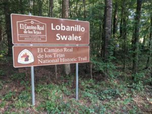
The historic resources report for the Lobanillo Swales Project revealed information that has yet to be incorporated in the historical narrative and historic context of East Texas. The historic written records provide documents and maps that describe and show the location of the Lobanillo Swales road segment from the Spanish Colonial Period through the Republic of Texas Period. GTI encountered multiple potential locations of the historic El Lobanillo Rancho. These location were based on descriptions in Spanish records, previous researcher’s translations of historic documents, depositions from court records, and from oral histories of descendants whose relatives owned the land in historic times. Documentation of the broader perspective of El Camino Real de Los Tejas was also collected during the archival review for the historic resources report. These historic maps depicting El Camino provides the general perspective and context of the road in relation to cities, towns and river crossings. The discussion continues with Antonio Gil Y’Barbo as an individual that had a role in the significant historic events in Texas. At the end of this chapter, we provide our assessments and conclusions about the potential locations of Lobanillo Rancho and Pifermo’s Chichi Rancho along with important comments about our translation of the 1794 and 1810 Spanish land transfer request and approval documents.
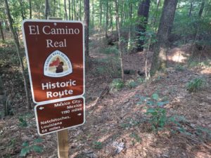
The historic resources report for the Lobanillo Swales Project provides supporting historical records identifying Lobanillo Swales as part of the El Camino Real during the Spanish Colonial era through the Republic of Texas period. Four potential locations were identified for the historic site of El Lobanillo Rancho (Figure 119). The first location suggested by Blount which places the ranch on Aish Bayou near the Mission Delores de los Ais. The second suggested by Mrs. White’s research, as the town of Geneva, Texas. Third from information compiled by Ramos (1978), Peterson (1995), Williams (2007), and Toole (1983) places El Lobanillo Rancho in the close vicinity of the Lobanillo Swales Road Segment, possibly adjacent and south of Highway 21. The fourth location compared the above information along with Brune’s (2002) description of the location of Lobanillo Springs. Ramos’s (1972) comments regarding the inn run by the Maximillian, places the site still in the vicinity of Lobanillo Swales, but north of Highway 21. The documentation of the broader perspective of El Camino Real de Los Tejas revealed the location of a second ranch named “Chichi” owned by Jean Baptiste Ignace Piedferme aka Juan Ignacio Pifermo (see Figure 119). Since the 1773 historic written records show that Lobanillo Rancho was already a pueblo, historical archaeologists can consider that the rancho has many components. The challenge will be to identify the earliest rancho components from latter components over time. The types of artifacts and provenance of the cultural material assemblages may indicate early and later Spanish behavior traits described as obsequious to King and Pope and assertive and confidant in the negotiation and construction of individual identities presented in the Archaeological Survey and National Register Testing Research Design (Iruegas and Iruegas 2015). The discussion regarding Antonio Gil Y’Barbo identify him as an individual that led his people through the changing events of removal and resettlement of East Texas. The significant historic events such as the evacuation of East Texas and the re–founding of Nacogdoches shaped Texas history.